Alps: Will it snow before the holiday starts?
It's the middle of winter, but the only records being broken at the moment are temperature records. This as the “traditional ski holiday” begins for many people next week. The question that will concern many people at this moment is; Will there be more snow? The answer to that is yes, but it is not yet certain whether there will be a good amount of snow everywhere.

Some snow in France and Switzerland on Wednesday
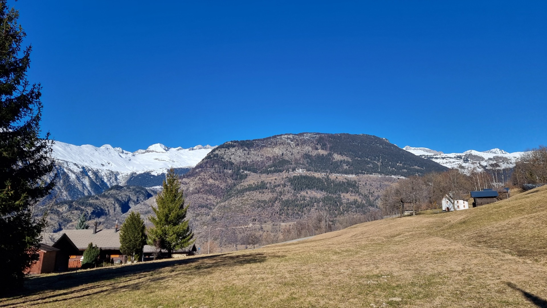
It will not escape anyone's attention, as it is very mild in the Alps. This moderate weather is due to high pressure in the Frank area. Its core is located above mainland Europe, and it originally pumped tropical air from the south towards western Europe. Many heat records have been broken, and there are even places in the Italian Alps that have reached temperatures of over 20 degrees. It is dry and sunny.
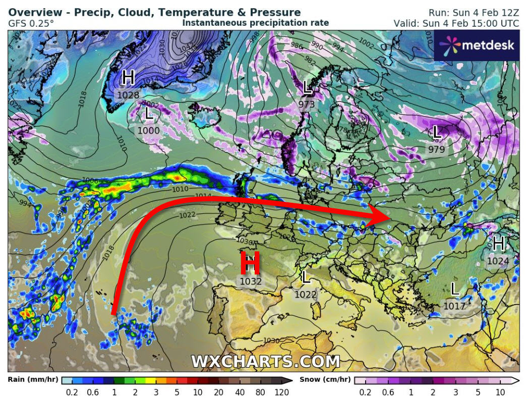

We haven't lost this soft air coming from Africa for a while. The average temperature today in the Alps is about 8-9 degrees at an altitude of 1500 metres. Tomorrow we will also reach high temperatures averaging 7-8 degrees. It's dry and the sun will shine, especially today. There is a great deal of wind from the west.
On Wednesday, a front approaches from the northwest, then the high pressure area begins to slowly lose its influence. This will cause some precipitation, especially in the French and Swiss Alps, from the evening and night until Thursday. The snowfall limit ranges between 1,400-1,500 metres, and amounts are limited to a maximum of 10 centimetres. Unfortunately, there will be many places where it will rain. See weather maps below:
From Friday south
It will be even more exciting again from Friday. From Thursday we see the weather in the Alps increasingly under the influence of a low pressure area moving towards France. We will then see the development of a low pressure area over the Gulf of Genoa over the weekend. This means a dryer will develop on the north side of the Alps from Thursday and possibly continue into the weekend.
At the same time, humid air from the south (from the Mediterranean) begins to push towards the southern side of the Alps. This is Sudstaw It is expected to continue throughout the weekend with large amounts of rain expected. Regarding quantities, there is still a lot of uncertainty at the moment. Although it seems that more than a meter of snow could certainly fall on the southern side of the Alps at higher altitudes!
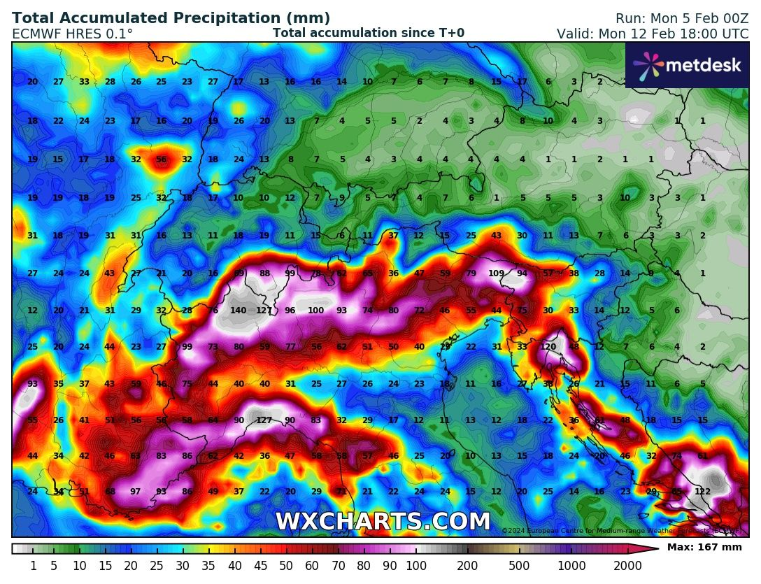

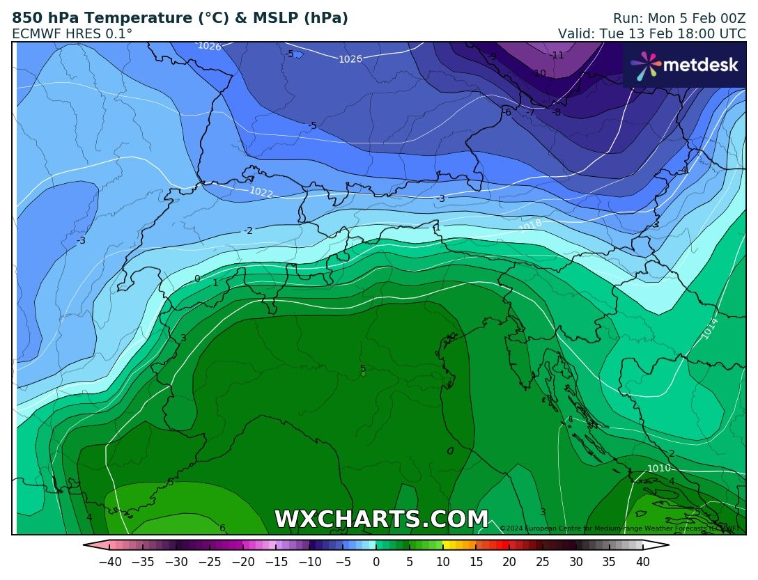
The cold air that will then flow over the Alps will have a hard time, causing the snowfall line to be very high for some time, around 1,500 to 1,200 metres. However, if heavy rainfall continues, the snowfall limit in the protected valleys will be much lower and the snow may extend into the valley. In neighboring inland Alpine regions such as Valais, snow initially falls from 2,000 to 1,800 metres.
It drops to 1500 meters over the weekend to 1000 meters on Sunday. Dry and smooth with a hair dryer for longer on the north side of the Alps. For example, the temperature could reach more than 15 degrees in the valleys in Austria this weekend. On Sunday and Monday, the level of the two craters will decrease from west to east and cold air may spread further over the Alps. Then the snowfall limit drops to an altitude of 800 metres. However, Rainfall and Staw disappear again.
advertisement
A diverse and beautiful ski area in Switzerland
Are you looking for a nice ski area, suitable for both advanced and beginner skiers, with a good range of slopes, good food on the slopes and guaranteed snow? Then go to Crans-Montana in the Swiss Alps this winter. Read more
advertisement
Winter sports in Innsbruck
Enjoy the pure life for an unforgettable winter vacation. Here you can reach the refreshing heights of Nordkette from the heart of Tyrol's capital within twenty minutes. The historic center with its famous tourist attractions is a stone's throw from thirteen ski areas. A ski tour or winter walk is never far away in Innsbruck. Read more
advertisement
Ortofox: sustainable safety in the mountains
Ortovox produces the best outdoor sportswear and associated accessories, also for winter sports, in a completely climate-neutral way. What started in 1980 with a revolutionary avalanche transceiver led to the development of a high-tech air bag system. This is of course in addition to clothing and tools that are comfortable, stylish and always focused on safety.
If you would like to learn more about Ortovox, click below. In the Netherlands you can buy Ortovox from TwinSeasons. Read more
The northern side of the Alps
What about the North Side, I hear you thinking? That's all for now. As the European model rainfall map above shows, not much falls on the northern side. Plus, the high temperatures expected this weekend due to the hairdryer will only make things worse there. Starting Monday, convincingly cold air will enter and then only a small amount of snow will fall until Tuesday, according to weather maps now. However, this is next week, so it can still be manipulated.

Another update tomorrow! More winter sports news and tips? Check that too Snowrepublic.nl And join Winter sports photo contest!
(Visited 4,456 times, 4,456 visits today)


Traffic controller and slip coordinator at Rijkswaterstaat. He is also a junior meteorologist at Weerplaza.

“Pop culture enthusiast. Unable to type with boxing gloves on. Analyst. Student. Explorer.”


