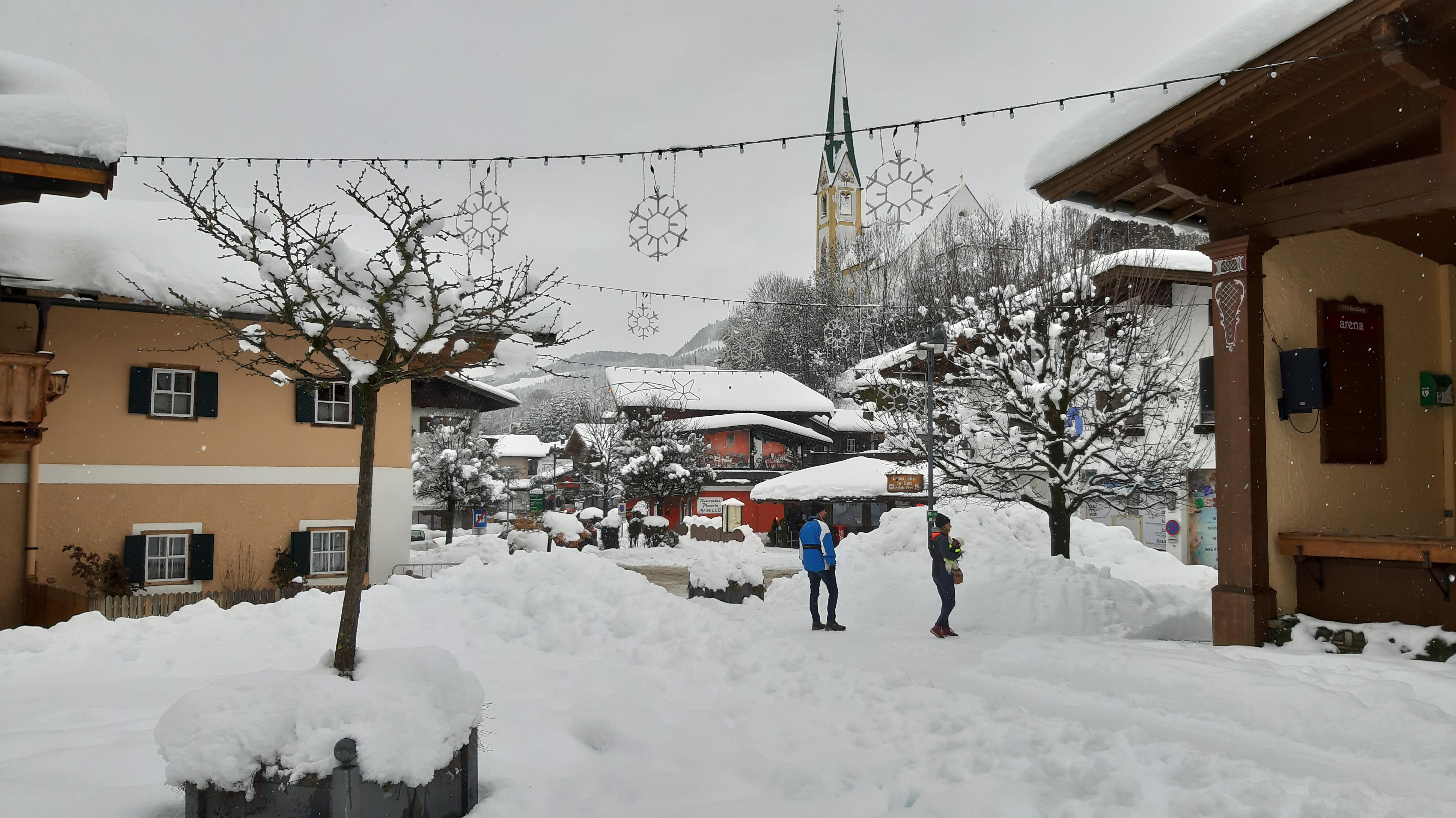
Last Tuesday, heavy snow fell in Schoburnau (Photo: Michael de Francière – De Jong)
We are leaving the mild weather and thawing of the Alps in recent weeks behind us for now. After some wintry twinges earlier this week, a turnaround is set for tomorrow with significant amounts of snow. Especially in Austria and Italy, spring break will end with heavy snowfall.
As for today, Thursday, the weather remains relatively mild. Strong southwesterly winds bring warm air, causing temperatures on the north side of the Alps to sometimes rise to 15 degrees or higher. There is also a lot of cloud cover and rain falls from the cloud cover in the French and Swiss Alps, and snow only falls from an altitude of 2200 metres.

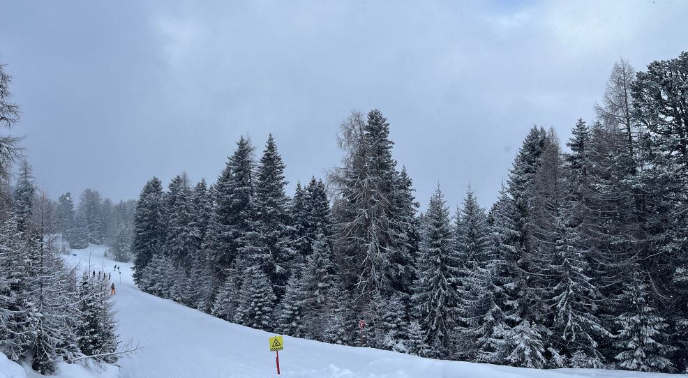
Fresh snow earlier this week in Nauders (Photo: Marèse Merbis)
Cover with snow dump
Tonight, rain will fall everywhere in the Alps, at the same time the wind will shift to the northwest and cold air will flow into the mountains. As a result, the snowfall level will slowly decrease to 1,500 meters overnight until Friday and thereafter to 1,000 metres. As a result, we can expect a white landscape almost everywhere above 1000 meters at the end of the night.
Tomorrow, Friday, snow will continue for a long period in the northeastern Italian and Austrian Alps. Only in Vorarlberg will snowfall decrease quickly, elsewhere it will continue to snow until the evening hours. Snowfall ranges between 700 and 1,000 metres, and rain only falls in the low valleys. However, weather conditions are very different in the Western Alps, where the sun shines abundantly again during the day after snowfall. Because the weather freezes again during the day on most ski slopes, conditions will be good.

Regionally, snow falls by about a meter! (File photo: Jeroen Elfrink)
The Italian Alps will remain sensitive to some snow showers on Saturday, but will remain dry elsewhere and the sun will shine. Above 1200 metres, the temperature remains below zero during the day, and combined with fresh snow, the conditions for winter sports could not be better. The sun will also shine for a long time on Sunday, especially in Austria. New clouds will appear from the west during the afternoon.
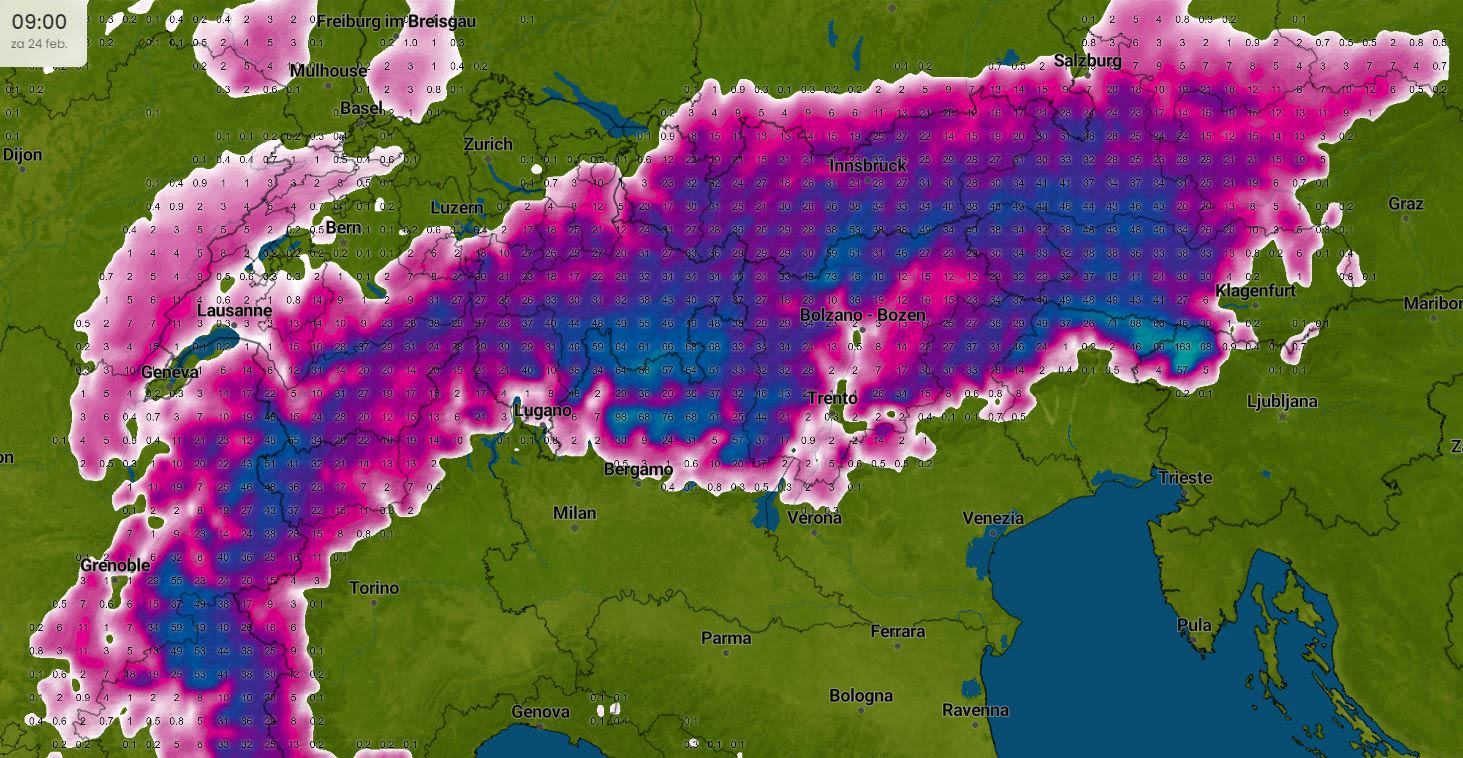
This is how much snow will fall on Friday
Eventually, a thick layer of snow is expected to fall over almost the entire Alpine region. The French and Swiss Alps are expected to receive between 20 and 40 centimeters of fresh snow, with ski resorts such as Val Thorens receiving up to half a metre. Heavier amounts of snow are expected to fall from the Raetian Alps, through the Dolomites towards Karawanken. Popular winter sports destinations such as St. Moritz, Sölden or Mültal can prepare for a significant amount of snow, ranging from half a meter to a full meter of fresh snow locally!

Snow forecast in centimeters (Source: Imweather.com)
Significant new snowfall is also expected in the popular regions of Tyrol and Salzburg, mostly between 20 and 50 cm thick. However, there is relatively little rainfall on the border with Germany, and southern Germany also receives less fresh snow than elsewhere. For example, only 10 to 20 cm of snow is expected in Garmisch-Partenkirchen, and rain is likely to continue in the valley.
Good weather on the return trip?
Anyone returning to the Netherlands from the Alps on Saturday can expect favorable travel conditions. A few showers may occur across Germany or northwest France. However, there is no winter weather, except in the Alps themselves where wintery and slippery conditions are possible. For those returning home on Sunday, it is recommended to take into account some rain later on the way. However, temperatures are still too high for slipping or snow on the road. There is also not a lot of wind, in short, ideal travel conditions.
Perfect weather for winter sports after the weekend
Ideal weather for winter sports will continue even after the weekend. New snow is expected to fall regularly, especially in the Western Alps. Moreover, it generally remains cold enough, with frost persisting at an altitude of 1,200-1,400 metres.


