Why are there so many hurricanes, especially in the US?
Devastating tornadoes have been raging across America for weeks now; Especially the center of the country should be affected. But why this part in particular?
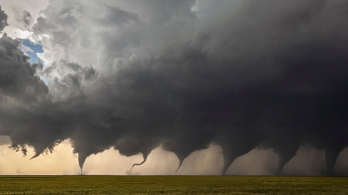
Between April and June, the United States is hit by hundreds of hurricanes each year. In 2011 — known as the Year of the Tornado — no fewer than 857 tornadoes touched down across the country in April. 226 of them on April 27 alone, a one-day record. This year’s hurricane season started early: in early March, the media talked about the first powerful hurricane. Texas, Oklahoma, Kansas, South Dakota, Iowa and Nebraska are particularly affected. Hence this area was named Tornado Alley. But why are there so many cyclones here?
read more:
Heavy thunderstorms
The most powerful tornadoes form mainly from a type of thunderstorm, the supercell. Such showers are accompanied by a lot of wind, rain, hail, lightning and sometimes one or more tornadoes. A supercell cloud is characterized by a rotating core called a mesocyclone.
A mesocyclone requires multiple air currents at different heights, all with different directions and speeds. The layer of air in between therefore forms a horizontal, cylindrical windshaft (see Figure 1 below; the windpipe is shown in green).
This does not cause a supercell. It also requires warm, moist air blowing just above the ground. Warm air is lighter than the cooler upper layer and therefore rises. Due to this rise, the horizontal wind shaft rotates to a vertical position. The warm air then circulates along the tube (mesocyclone) (see images 2 and 3 in the figure below). Supercell was born.

A developing hurricane
How a tornado develops from a thunderstorm is still poorly understood and perhaps more complex. But some things are clear. Warm air cools further as it rises, condenses and descends again as moist, cold air. Part of it is swallowed up by the rising and swirling air. There, water droplets condensed from the cold air form a new swirling cloud under the supercell (see image below).
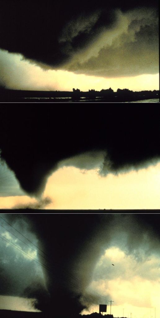
The supply of cold air ensures that the wind shaft becomes increasingly narrow, but at the same time more powerful. As a result, the warm moist air above the ground is swallowed up more violently, creating a low pressure area there. To compensate for this pressure difference, the cloud beneath the supercell is pulled downward. Then it looks like a cyclone is growing towards the earth. Once the earth and cloud are connected, we officially call the wind jacket a hurricane.
The top image in the adjacent image series shows the cloud forming beneath the supercell. The two photos below show the tornado forming. Image: Harald Richter, NOAA
Often the lifetime of a tornado is not long, averaging about 10 minutes and some disappearing after a few seconds. But powerful models can stay on the collision course for up to an hour. Wind speed will be more than 300 kilometers per hour.
Tornado Incubator
In tornado corridors, conditions are favorable for supercell thunderstorm formation. For example, the region receives a steady supply of warm moist air from the Gulf of Mexico to the southeast. And from the northwest, cold, dry winds blow over the Rocky Mountains.
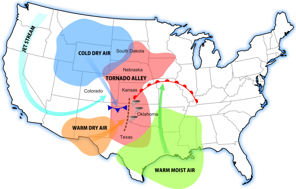
But there are two other air currents that contribute. For example, dry warm air blows from Mexico, which increases the temperature difference between sea air and mountain air. When they meet, the warm air rises faster and with more energy. In addition, there is a jet stream, a very strong wind at an altitude of about 10 kilometers blowing into the region from the west.
This cocktail of different air currents creates unstable atmospheric conditions, making Central America an ideal hurricane breeding ground.
Curious why there are no hurricanes in the Netherlands? You can read it here.
proof’s: KNMI, James Spahn, National Geographic, NWS

“Coffee fanatic. Friendly zombie aficionado. Devoted pop culture practitioner. Evil travel advocate. Typical organizer.”