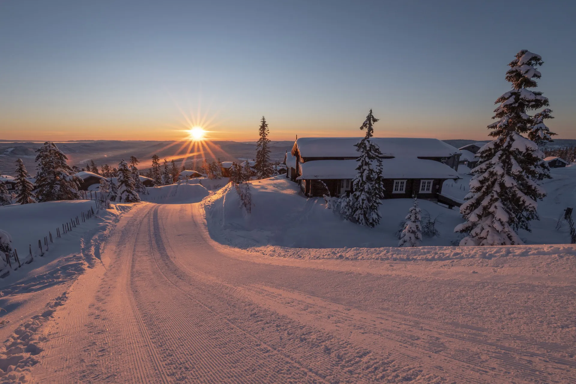
Alpen-Sauerland weather forecast cold and snow for the holidays
Yesterday we mentioned that there will be new snow for the Alps. It’s also going to get colder and winds can be quite present. Good news for winter sports fans at the start of the second week of spring break. We review the latest ideas. Conditions will also improve in Sauerland. Since a lot of people also go for a vacation there, we also take a look at this weather forecast.
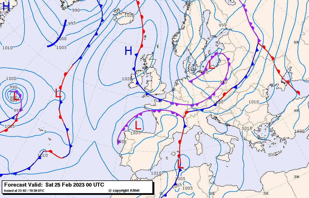
Weather reversal due to a cold front from the north
If we look at the weather map, we see a high pressure area over the Atlantic Ocean west of the UK and a low pressure area near southern Sweden and Denmark. Between these two pressure systems, a north-south slide of cold air is created. The cold front that belongs to the low pressure area will be the source of the fresh snow.
It will rain this afternoon and especially tonight before the actual cold front arrives. Nord Stau is rising due to the oncoming North Stream. Since the cold front is still over central Germany around the afternoon, the Alps are still in thin air and rain will be mainly in the valleys. The snowfall limit is about 1500 metres. During the evening and night, it will slowly begin to descend as cold alpine air slowly invades. Therefore, traffic to and from the winter sports areas will have to deal mainly with rain in Germany tomorrow and snow from 1,500 meters in the Alps. Beware of the snow chains during the continuous snowfall in the mountains.
On the maps below we see the afternoon snowfall line on the left. The cooler air can be seen with the blue grid at the top of the map. On the right is the early evening rain according to the German icon. The intermediate precipitation zone is the actual cold front. Precipitation that already borders the Alps is precipitation due to the Nordstau occurrence. The upper rainfall area is another shower line. In Germany it is mainly about rain, except for the higher parts of the low mountain ranges. During the passage of the cold front, the winds also increase.
Fresh snow north of the Alps
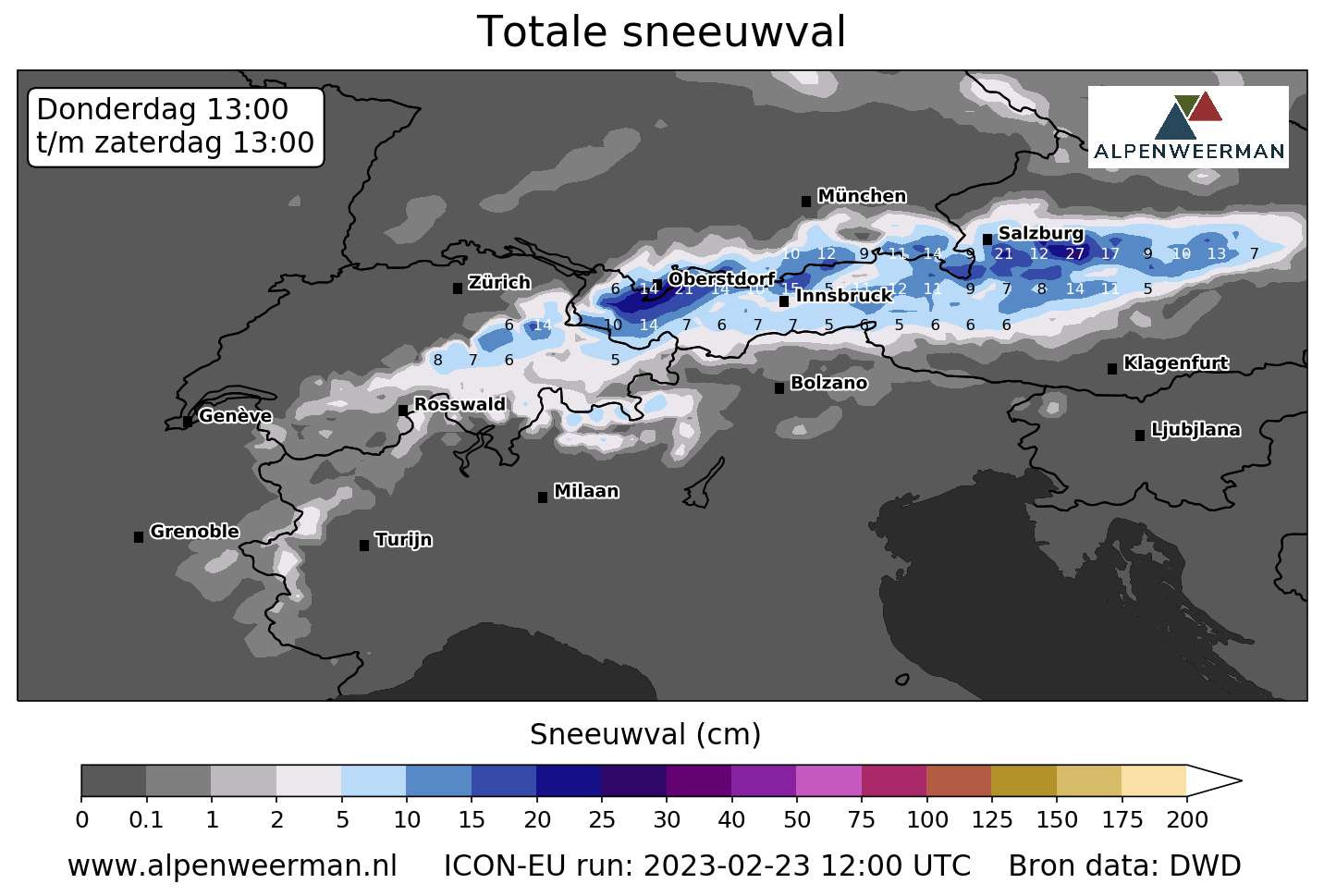
Precipitation will get more intense on the north side of the Alps tonight, due in part to an upcoming cold front. The snowfall limit drops to about 1,000 metres. The rain will turn to snow in more places. Most snow is expected in an area extending from eastern Switzerland, for example, beyond the Salzburgerland region. In Switzerland the average fall is 5 to 10 centimeters, Austria has the best credentials. It is found in many places from 10 to 20 cm long and locally even over 30 cm long.
During the morning the snow will be less heavy, but it will not be completely dry. Stowe areas remain sensitive to some light snowfall or snow showers. At the end of the afternoon, an area with new snow showers is approaching from the north side of the Alps and it will often snow again. Favorite areas remain the north side of the Alps in Switzerland and Austria and there can be about 10 cm. It’s a completely different story in the south of the Alps and especially in Italy. It will stay dry there and the sun will shine brightly. This sunshine is mainly caused by the northern hair dryer; The wind will still be there. It will also stay dry in France, and traffic will not be affected by the snowfall there.
Very cold, there will likely be a snow dump on the way
On Sunday, the cold air well invaded the Alps. However, it is cloudy in many places and there may still be snow showers. It will still be very windy and that, combined with the cold, will lead to less ideal conditions on the slopes. Beware of the cold wind cuts and make sure you wear good clothes. The highest slopes would freeze hard, and the snowfall limit lowered into the valleys.
In the Alps, the theme quickly turns into Monday. The low pressure area could then provide a lot of snow in the Southern Alps, especially in Piemonte. Some models come with a scale. We owe this to the moist air from the Mediterranean that crashes into the mountains from the east, causing a heavy stow. More on that in the next post, hopefully there will be more certainty. All in all, a prospect of alpine winter that’s great after all the poor soft and snowy days!
Sauerland
Finally, Sauerland, conditions will of course improve there too. I was there myself last week and the valleys are all green. Only higher in the mountains there is still some snow in the forest. Slopes are fairly good. Of course the snow was a bit soft due to the mild weather, but thanks to the snow cannons there was still about 50cm left on the slopes. The pictures below were taken there in Willingen.
The same cold front will reach Sauerland at the beginning of the afternoon and will pick up there with a new layer of snow. At the highest peaks the snow will begin immediately, and in the valleys it will rain first. However, the snowfall line continues to fall, it is still about 800-700 meters on Friday afternoon, and it will be about 300 meters on Saturday morning. During the evening, the rain will also turn to snow below. The expected amounts in the villages range from about 5 cm to 10 cm at the highest peaks. The wind is northerly moderate.
On Saturday, the sun rises at the end of the morning and the weather is certainly not bad. Above a layer of fresh snow, conditions on the slopes will be lovely. Mercury freezes in the valleys and freezes slightly at the top. At the end of the afternoon and in the evening, there will be some snow showers and it may fall a few centimeters again. On Sunday and the start of the new week, the conditions are great in the Sauerland. The sun is working overtime, the wind is weak and freezing a bit during the day and locally moderate to severe at night. The new layer of snow in the villages will give the feeling of winter. Snow cannons can fully operate in frost and this, combined with fresh snow, will greatly benefit the slopes.
(visited 14 times, 14 visits today)

Road traffic controller and skid coordinator at Rijkswaterstaat. Also a junior meteorologist at Buienradar.


“Pop culture enthusiast. Unable to type with boxing gloves on. Analyst. Student. Explorer.”